

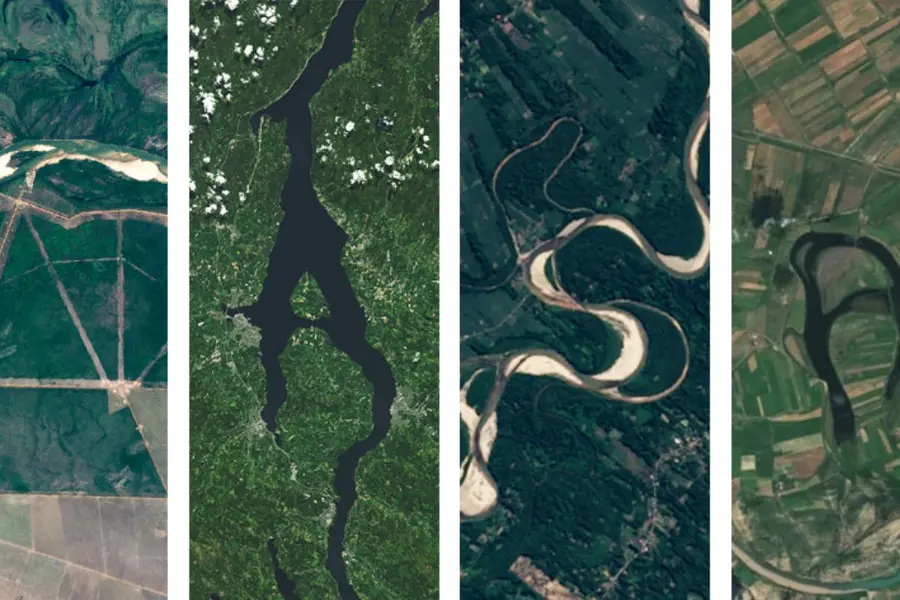

Have you ever imagined seeing your name displayed across a landscape captured from space? Satellite imagery offers a fascinating way to explore the Earth, discover geographical patterns, and create visually interesting designs. The concept of your name in Landsat brings together creativity, geography, satellite technology, and personal expression. It encourages people to think about how names, letters, and visual patterns can connect with the natural features of our planet.
Landsat is a long-running Earth observation program that collects images of the Earth’s surface using specialized satellite sensors. These images help scientists, researchers, students, and environmental professionals understand changes in forests, farmland, rivers, cities, and other landscapes. Although Landsat was developed primarily for scientific observation rather than displaying personal names, its imagery can inspire creative projects that combine geographical information with typography and digital design.
The idea can be explored in several ways, including designing a name over a satellite image, arranging letters using landscape features, or creating artwork inspired by the colors and textures visible from orbit. Understanding how Landsat works makes these creative possibilities even more interesting because the imagery represents real information about the Earth’s surface.
What Does Your Name in Landsat Mean?
The phrase your name in Landsat can describe a creative concept in which someone’s name is presented using satellite imagery, Earth observation backgrounds, or landscape-inspired visual elements. It may involve placing a name over an image of a city, arranging letters across a natural landscape, or using satellite imagery as the background for a personalized digital design. The exact meaning depends on the project and the method used to create the final result.
Unlike a conventional name generator, Landsat does not automatically transform a person’s name into satellite imagery. Instead, the idea combines existing Earth observation data with graphic design techniques. For example, someone named Rahul might choose a satellite image of a green agricultural region and place the name over it using clear lettering. Another person might use a coastal landscape, mountain ranges, or a city image to create a distinctive visual effect. The satellite image provides the geographical context, while the name adds a personal element.
Understanding the Landsat Satellite Program
Landsat is a joint Earth observation program developed by NASA and the United States Geological Survey. Its history began in 1972 with the launch of Landsat 1, making it one of the longest-running sources of satellite imagery for monitoring land conditions. Successive generations of satellites have improved the quality and usefulness of the information collected, helping researchers compare landscapes across different periods.
The program is particularly valuable because its observations support long-term environmental analysis. Scientists can use Landsat imagery to examine deforestation, agricultural development, urban expansion, water availability, wildfire impacts, and changes in land cover. These applications demonstrate that satellite images are much more than attractive photographs. They contain information that can be interpreted to understand environmental processes and human activities.
When creating artwork inspired by Landsat, this scientific background offers an additional layer of meaning. A personalized name design can feature a location that matters to the creator, such as a hometown, a favorite natural area, or an agricultural region. The result becomes more meaningful when the selected image represents a place with personal or geographical significance.
How Landsat Images Capture the Earth
Landsat satellites observe the Earth’s surface using instruments that measure reflected sunlight and, in certain spectral bands, emitted thermal energy. Different wavelengths reveal different characteristics of land, vegetation, water, and other surface materials. This process allows researchers to examine features that may not be obvious in ordinary photographs.
For instance, healthy vegetation often reflects near-infrared energy strongly, while water generally absorbs much of it. By comparing measurements from different spectral bands, analysts can create specialized images that highlight vegetation, surface moisture, geological features, or built-up areas. These combinations can produce vivid colors that differ from what the human eye normally sees.
These visual properties can also inspire creative projects. A designer exploring your name in Landsat might choose a natural-color image for a realistic appearance or a false-color composite for a more artistic result. The key is to understand that the colors in some satellite images represent measured data rather than the exact colors visible on the ground.
Different Ways to Create a Name-Inspired Landsat Design
There is no single method for turning the idea into a finished design. The most suitable approach depends on whether the goal is a simple personalized image, an educational project, or a more sophisticated artwork that uses actual geographical data.
One straightforward option is to use a Landsat image as a background and place the desired name over it. A location with rivers, forests, coastlines, or agricultural patterns can create an appealing backdrop. Choosing a readable font and a contrasting text color helps the name remain visible without hiding important details in the image.
A more advanced approach involves creating letter shapes from geographical patterns. For example, a designer might combine cropped landscape images, textured terrain, or separate satellite-image sections to build individual letters. This requires more image editing and careful arrangement, but it can create a distinctive composition. It is important to recognize that such a design is generally a creative interpretation, not a standard output generated automatically by the Landsat program.
Tools and Techniques for Designing Satellite Name Art
Different digital tools can help users combine satellite imagery with text, shapes, and other graphic elements. Basic image editors are sufficient for placing a name over an image, while more advanced graphic design or geographical information systems can support detailed compositions.
The following table summarizes common approaches and their practical uses.
| Design approach | Main purpose | Skill level |
|---|---|---|
| Text over satellite imagery | Create a simple personalized design | Beginner |
| Landscape-inspired lettering | Build letters using image textures | Intermediate |
| Satellite image collage | Combine multiple geographical scenes | Intermediate |
| GIS-based map composition | Connect a name design with spatial data | Advanced |
| False-color satellite artwork | Produce a scientific or artistic visual effect | Intermediate to advanced |
For a beginner, the simplest workflow is usually the most effective. Start with a suitable satellite image, select a clear font, position the name, and adjust the contrast. More complex methods are worth exploring when the project requires precise geographical alignment, multiple images, or a detailed artistic composition.
How to Create Your Own Landsat-Inspired Name Design
Creating a personalized design does not require professional remote-sensing knowledge. A basic understanding of image editing, thoughtful image selection, and attention to typography can produce a polished result. Before beginning, decide whether the design should look scientific, artistic, educational, or personal. This decision helps determine the image style, font, colors, and overall layout.

A simple workflow can make the process easier:
-
Choose a satellite image with a landscape that complements the intended design.
-
Select a readable font and position the name where it remains easy to see.
-
Adjust contrast, brightness, and text placement to balance the image and lettering.
-
Export the finished artwork in a resolution appropriate for its intended use.
After completing the initial design, review it at different sizes. A name that looks clear on a large monitor may become difficult to read when displayed as a small social media image. Maintaining enough contrast between the letters and the background improves readability. You can also add a subtle outline or shadow if it does not distract from the satellite image.
For a more geographical approach, consider using a location that has a meaningful connection to the name’s owner. A hometown, a memorable travel destination, or a landscape associated with a personal interest can give the artwork a stronger identity. This approach makes the final design more than a decorative combination of text and imagery.
Creative Uses for Landsat-Inspired Name Art
Satellite-inspired name designs can serve several purposes beyond personal entertainment. Students can use them to introduce Earth observation concepts during geography presentations or classroom activities. By selecting an image of a forest, river, or city, they can explain how satellite observations help researchers understand land use and environmental change.
Teachers can also use personalized designs to make remote-sensing lessons more engaging. For example, students might create a title graphic for a project about agricultural regions, then discuss what the satellite image reveals about vegetation patterns or settlement development. The name design becomes an entry point for learning rather than the main scientific result.
Digital artists may approach the idea differently. They can combine satellite textures with typography, abstract shapes, and carefully selected colors to create posters, digital wallpapers, or presentation covers. The strongest designs preserve enough detail to make the geographical imagery recognizable while allowing the lettering to remain the main visual feature.
Important Differences Between Satellite Imagery and Name Generators
A common source of confusion is the assumption that every phrase involving a satellite program refers to an existing automated tool. Landsat is an Earth observation program, not a dedicated service for generating personalized names. Its primary purpose is to collect data that supports scientific research, environmental monitoring, and land management.
A name generator, on the other hand, typically uses predefined rules, templates, or artificial intelligence to create text-based outputs. A satellite-inspired design may use such tools alongside an image editor, but the design process is separate from Landsat’s actual observation system. Understanding this distinction helps users set realistic expectations and choose suitable tools.
There is also a difference between using authentic satellite data and using a generic image that merely resembles a satellite view. Authentic Landsat imagery originates from observations collected by the program’s satellites. A stylized background might imitate the appearance of Earth from orbit without representing a real Landsat scene. Both can be useful for creative purposes, but they should not be described as equivalent when accuracy matters.
Benefits of Exploring Landsat Through Creative Projects
Combining satellite imagery with personal design can make a technical subject more approachable. People who initially find remote sensing difficult may become interested when they see how geographical data can be used to create meaningful visual compositions. The process encourages experimentation with color, texture, image selection, and layout while introducing basic concepts about how satellites observe the planet.
It can also improve visual communication skills. A successful design requires the creator to decide which information deserves attention, how to organize the composition, and how to maintain a balance between text and imagery. These are useful principles for presentations, educational posters, digital publications, and other visual projects.
Another benefit is the opportunity to explore environmental awareness. Choosing a satellite image of a forest, coastline, lake, or growing city can prompt questions about how that place has changed over time. Although a name design does not replace scientific analysis, it can encourage curiosity about land cover, climate-related impacts, and the role of Earth observation in understanding our surroundings.
Common Mistakes to Avoid When Creating Satellite Name Art
One common mistake is selecting an image with too many competing details. Satellite imagery can contain complex patterns, roads, field boundaries, clouds, and differences in surface color. When text is placed over a visually busy region, the name may become difficult to read. Choosing a less crowded area or using a subtle text background can solve this problem without removing the character of the image.
Another mistake is treating every satellite image as a conventional photograph. Some Landsat products use false-color combinations or processing techniques designed to reveal specific surface characteristics. Their appearance may be unusual, but that does not necessarily mean the image is inaccurate. Understanding the type of image being used helps creators choose an appropriate visual style and describe the result correctly.
It is also important to avoid stretching or compressing letters excessively to fit a landscape. Although unusual typography can be effective in artistic work, distorted lettering often reduces readability. A balanced design should allow the name to stand out while preserving the natural patterns that make satellite imagery interesting.
The Future of Satellite Imagery and Personalized Digital Design
Advances in image processing, artificial intelligence, and accessible geospatial software are creating new ways to work with Earth observation data. Users can increasingly combine geographical information with creative editing techniques to produce maps, visual summaries, educational graphics, and digital artwork. These developments may make satellite-inspired projects easier for beginners while offering more advanced options to experienced designers.
Artificial intelligence can assist with certain design tasks, including selecting visual styles, generating layout ideas, and helping users refine text placement. Geospatial tools can provide a different kind of support by enabling image comparison, spatial analysis, and the organization of data from particular locations. When these capabilities are combined thoughtfully, creative projects can become both visually appealing and educational.
However, technical accuracy remains important. Automated tools should not be assumed to produce genuine Landsat imagery simply because their output looks like a view from space. Anyone creating a project for scientific or educational purposes should distinguish authentic Earth observation data from generated or heavily modified illustrations. This distinction preserves the value of the underlying information while allowing room for artistic experimentation.
Conclusion
The idea of your name in Landsat offers an imaginative way to connect personal expression with the science of Earth observation. By combining names with satellite imagery, creators can develop personalized artwork, educational graphics, presentation covers, and landscape-inspired digital designs. The concept is flexible enough for beginners who simply want to place text over an image and for advanced users who want to experiment with geographical data and complex visual compositions. Landsat itself remains focused on observing the Earth’s surface and supporting research into environmental and geographical change. Its imagery provides a rich foundation for creative work because it reveals patterns in forests, rivers, cities, farmland, and other landscapes. Understanding the program’s purpose helps users distinguish genuine satellite data from artistic interpretations while making better design choices.